
Use drone roof imaging in Cape Coral to document broad or difficult-to-access areas, then verify repair decisions with hands-on inspection where needed.
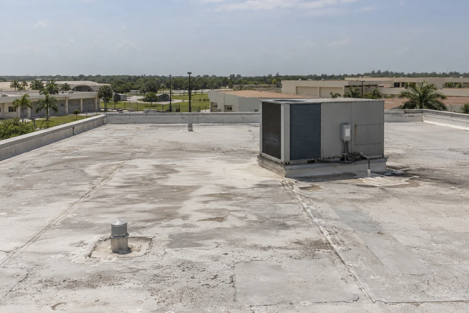
A roof camera can reveal a blocked drain or displaced edge across a wide field without putting an inspector on every section. Drone imaging is useful for documenting visible surfaces, access limits and areas that may need closer review. It cannot feel a loose termination, confirm membrane adhesion or determine whether insulation is wet. In Cape Coral, afternoon heat, humidity and changing weather affect when a safe flight and clear image are possible. We set the flight around the building, record what the camera can see and identify which findings require a hands-on check. The result supports a commercial roof inspection, not a substitute for one.
Choose the Right Roof Areas to Image
Before launching, confirm site access, airspace and property permissions, nearby people, obstructions, weather and the intended image record. The operator should have a safe vantage and a plan to stop if wind, rain, lightning or visibility changes. A route can prioritize broad roof sections, parapets, drains, rooftop equipment, transitions and inaccessible elevations. Overlapping frames at parapet returns and equipment clusters help limit image gaps where camera angles hide a section. A flight plan also helps the facility contact understand which areas will be captured and where staff should avoid during operation.
Large distribution or flex buildings near Pine Island Road may benefit from a consistent grid of overlapping images that shows the roof plane and equipment layout. South Cape’s compact commercial setting calls for a site-specific launch and access assessment, especially where public routes affect the camera path. Each site needs its own flight assessment. Do not promise complete coverage from a single pass or interpret an obscured section as defect-free.
For repeat imaging, retain roof plans and prior images with dates and camera orientation where available. Similar viewpoints can help compare visible changes, but seasonal shade, water, equipment and image angle can make comparisons misleading. Note conditions that differ between visits so a reviewer does not mistake a viewing change for roof deterioration.
Read Images as Evidence, Not a Diagnosis
Review still images and video for open seams, punctures, debris, ponding, displaced metal, deteriorated flashing, equipment conflicts and drainage obstructions. Mark each observation on a roof plan and preserve the original image with a clear location label. Zooming into a low-resolution frame can create false detail, so report only what the image supports. If a surface is shadowed, reflective, wet or hidden by equipment, identify the limitation instead of treating the area as inspected.
Water entry can begin at a detail that looks minor from above. A drone view may show a lifted edge but cannot confirm fastener withdrawal, substrate damage or wet insulation. Infrared equipment also has limits: thermal patterns can guide investigation but do not prove moisture. Use a moisture survey and selected core cuts when the owner needs evidence beneath the membrane, and use hands-on inspection to verify repair materials and attachment.
Compare current flight imagery with prior records and a ground or roof inspection before assigning a repair scope. For drone inspections, keep the flight plan, original image set and marked roof map together; schedule hands-on verification wherever imagery leaves a detail uncertain.
Coordinate Imaging With Facility Use
Drone work takes place above people and operating property, so coordinate the schedule, launch and landing area, safety perimeter and contact person. Keep entrances, loading areas and emergency access available as agreed. At Cape Coral Hospital, clinical access and rooftop equipment require careful coordination with the facility team. For industrial locations in North Cape Industrial Park, confirm loading traffic and roof access before selecting launch points. The building’s actual use controls the plan.
Warm-season storms and humidity may shorten the useful flight window or reduce image clarity. Secure the camera and equipment between passes, and stop if weather or wind creates unsafe control. Do not treat a delayed flight as evidence about roof condition. Reschedule or use a ground-based observation when imaging cannot be completed safely.
After the flight, share a concise image set with a labeled roof plan, date, route coverage, inaccessible zones and notable observations. Facility staff should be able to match a frame to a location without relying on the operator’s memory. If a visible defect needs intervention, separate the image finding from a confirmed diagnosis and explain what physical check comes next.
Connect Aerial Findings to Repair Decisions
Use imagery to direct a closer look, not to enlarge a repair without evidence. A suspected opening can be checked by a qualified inspector, and an active leak needs a traced water path through commercial leak investigation. A confirmed membrane or flashing issue may need a defined roof repair; repeated failures may call for replacement planning.
Make the next scope specific: roof section, observation, verification method and decision needed. Note if material identification, moisture testing, attachment checks or drain cleaning remain outstanding. A report that separates visible conditions from unverified ones helps owners set priorities without mistaking a high-resolution image for a physical assessment.
For property managers overseeing several Cape Coral buildings, keep flight files alongside inspection reports, leak logs and repair records. A multi-site program can standardize how locations, images and follow-up actions are named. For a multi-site roof program, use consistent image labels and flight records across the North Cape Industrial Park and Pine Island Road corridor properties, while setting access and launch points for each building.
Commercial Roofing Questions
What can a drone roof inspection show that a ground inspection may miss?
Aerial images can document broad surfaces, parapets and equipment layout from viewpoints that are difficult to reach on foot. They may reveal visible debris, ponding or displaced material. The image cannot confirm adhesion, attachment strength or concealed moisture, so findings that affect a repair need hands-on verification where safe and necessary.
Can drone images confirm that a roof is free of leaks?
No image can establish that every roof section is watertight. Water may enter beneath a detail and travel before reaching the interior, and visual coverage can be limited by angle, shade or equipment. Use flight results to direct inspection and compare them with interior leak reports and prior roof records.
What conditions can prevent a useful drone flight?
Wind, rain, lightning, poor visibility, nearby people, obstructions or site restrictions can make a flight unsafe or unproductive. The operator should assess access and permissions, establish a safe area and stop when conditions change. Cape Coral’s summer weather can shift the work window, so the plan should allow for rescheduling.
How should we use drone images after storm weather?
Preserve dated images, mark visible observations on a roof plan and compare them with earlier records where possible. Images document what was visible at capture time, not when a defect began or what caused it. Have a qualified inspector verify damage and define any repair after safe access is available.
Share the roof plan, access constraints and areas of concern. We will assess whether aerial imaging is suitable, capture visible conditions where safe and identify which observations need hands-on confirmation. Call 555-555-5555 or request a roof assessment for Drone Roof Inspection in Cape Coral, FL.